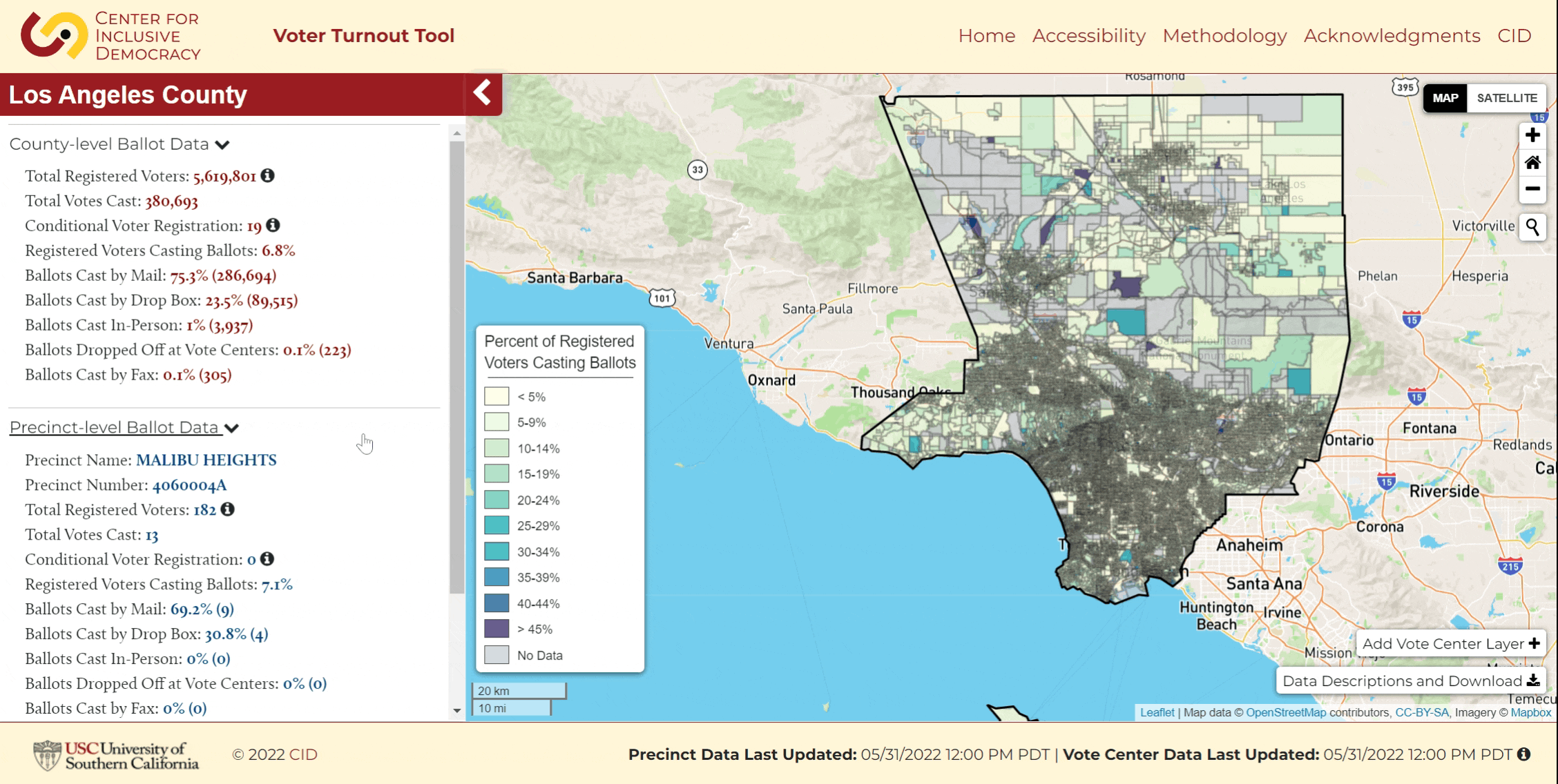
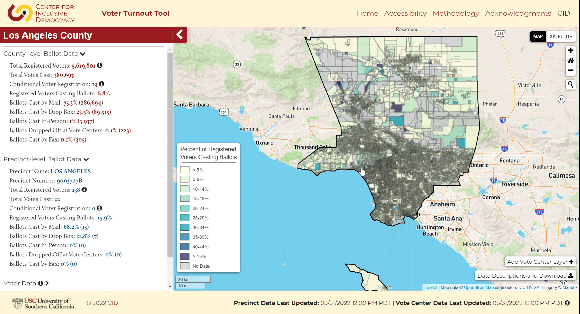
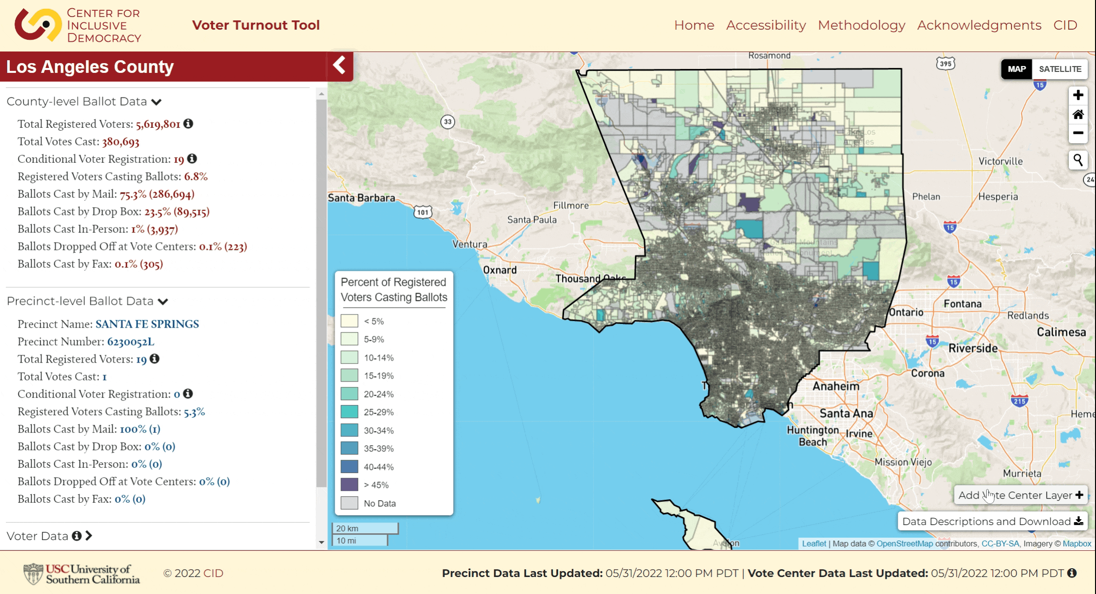
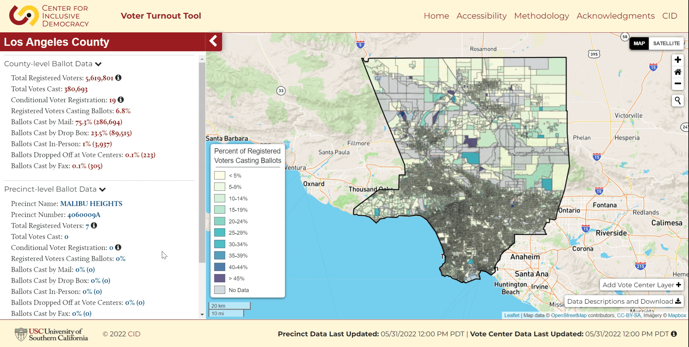
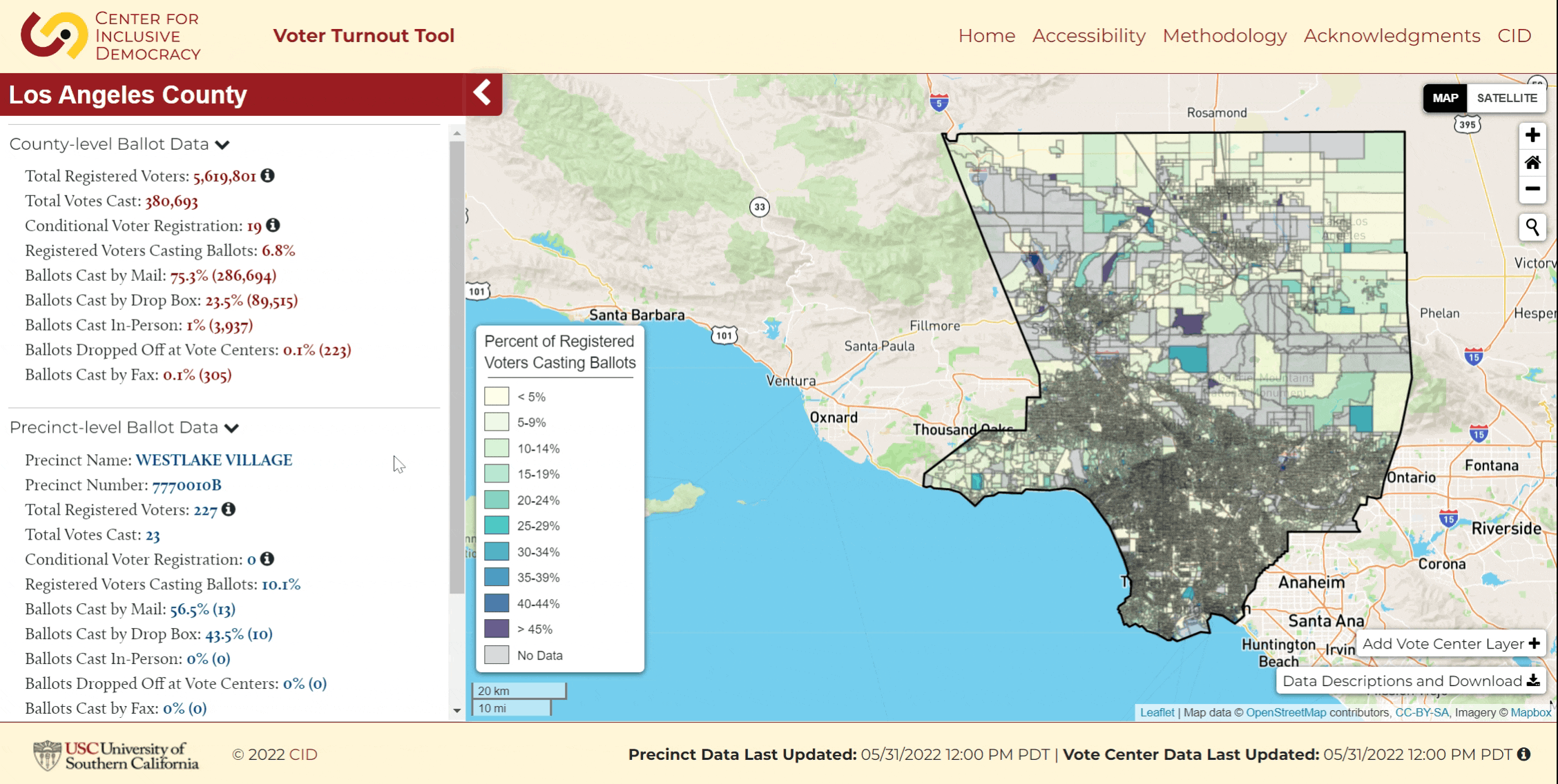
View Precinct-Level Ballot Data: Scroll over the map and view precinct ballot data in the sidebar to the left under "Precinct-level Ballot Data". Click to zoom to a precinct.
View Vote Centers: Click the "Add Vote Centers" button in the lower right corner of the map to view vote centers. Click on the clusters to view individual vote centers. Click on a vote center to view vote center data. Click the "Remove Vote Centers" button in the bottom right corner of the maps to stop viewing vote center data.
View Voter Data: Scroll down the sidebar to "Voter Data". Click to expand and click on a layer to view on the map. For layers with subcategories, click to expand and view. Click on the layer to remove and view precincts.
View Demographic & Population Data: Scroll down the sidebar to "Demographic & Population Data". Click to expand and click on a layer to view on the map. For layers with subcategories, click to expand and view. Click on the layer to remove and view precincts.
View Points of Interest: Scroll down the sidebar to "Points of Interest". Click to expand and click on a layer to view on the map. Click on a point to view more information (not available for all layers). Click on the layer to remove.